What's Next
Drone LiDAR (Light Detection and Ranging) & Photogrammetry
GDM Engineers
2/11/2025
What's Next for GDM Engineers: Expanding Our Capabilities with Advanced Drone Technology
At GDM Engineers, we're constantly looking for ways to stay ahead of the curve and offer our clients the best possible solutions. That’s why we’re excited to announce that we’ll soon be acquiring an industrial-grade LiDAR and photogrammetry drone to incorporate into our workflow. This powerful technology will enhance our ability to deliver even more accurate, detailed, and efficient surveying and mapping services.
What sets us apart from other firms is not just our expertise in UAS (unmanned aircraft system) piloting, but also the unique advantage we hold with our team’s additional capabilities. In addition to our skilled UAS pilot, we also have a certified private pilot on staff, bringing a level of proficiency and versatility that few competitors can match. This dual expertise enables us to operate in a wider range of environments and ensures the highest safety standards while conducting drone operations.
The integration of this advanced drone technology will allow us to offer enhanced LiDAR mapping, high-resolution aerial photogrammetry, and precise 3D modeling for civil engineering, construction, and environmental projects. Whether it’s a large-scale infrastructure project or an environmental survey, we are committed to providing our clients with data that is accurate, comprehensive, and delivered with unmatched precision.
We’re looking forward to utilizing this new capability to better serve our clients and continue pushing the boundaries of what’s possible in civil engineering.
Stay tuned for more updates as we continue to evolve and grow.
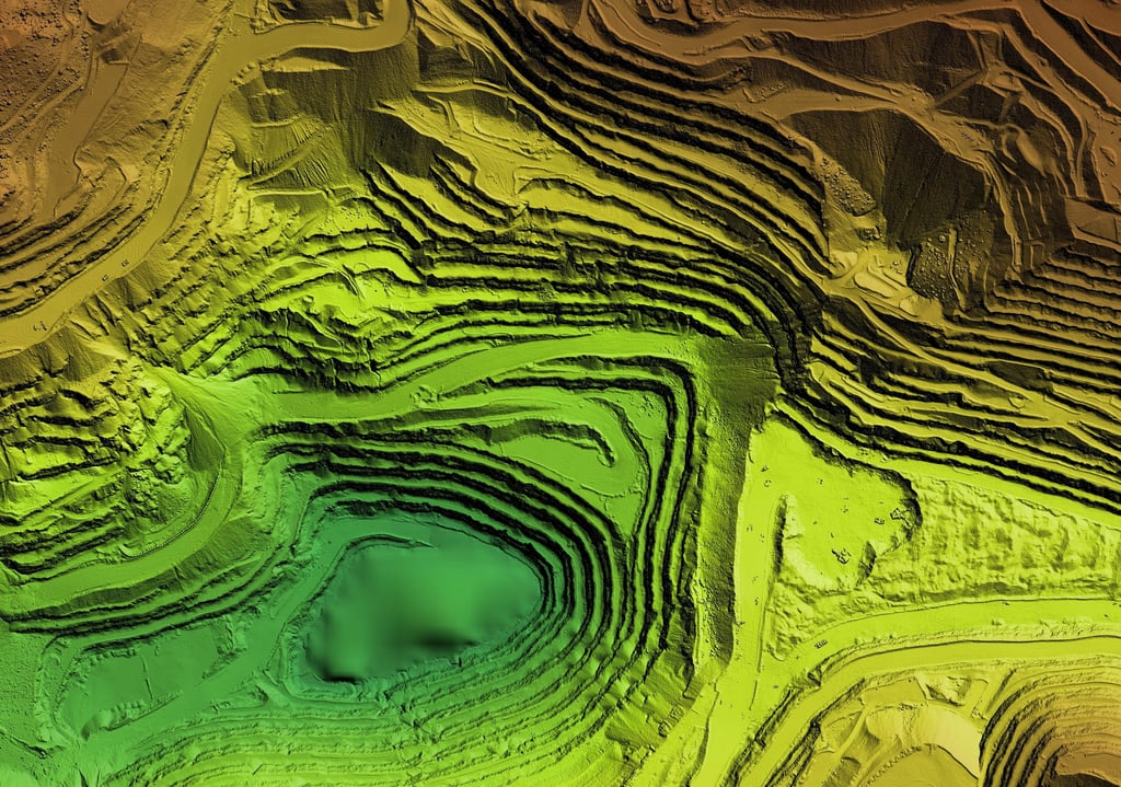
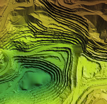
Digital Elevation Model (DEM): A GIS product generated by processing aerial LiDAR data captured by a drone. This model illustrates an excavation site with steep rock walls, providing a detailed and accurate representation of the terrain’s elevation and topography. The DEM delivers critical insights into the site's contours, enabling precise planning and analysis for ongoing and future excavation efforts.